Challenge:
A mid-size operator acquired several offshore assets, inheriting decades of well and seismic data, split across Petrel projects, spreadsheets, network drives, and physical media. Different business units used different naming conventions, coordinate systems, and versions of the same wells.
Teams lacked a single source of truth, slowing subsurface evaluations and delaying integration with corporate systems.
Solution:
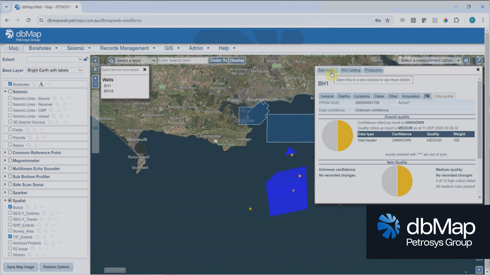
dbMap ingested the acquired datasets and aligned them to a PPDM-compliant corporate master, consolidating:
- well headers, directional surveys, logs, tops and cores
- 2D and 3D seismic index information
- leases, permits, basins and fields
- associated unstructured records through Records Management
Automated governance rules flagged mismatches, duplicates and missing metadata. Review workflows enabled data managers to validate updates before promoting them to the corporate master database.
Result:
- A unified subsurface reference dataset used across the organisation
- Faster screening of newly acquired blocks with trusted, consistent data
- Reduced rework as all teams accessed authoritative well and seismic information
- Clear audit history supporting regulatory and stakeholder reporting
Scenario
Operators routinely divest entire regional seismic libraries, such as selling all North Sea assets to another operator. Effective seismic contract management is critical during these, often billion-dollar transactions, where proprietary rights, entitlements, merged surveys, and physical media boundaries all determine what data can legally be transferred.
Challenge
Data management teams must confidently identify exactly what data is included in the divestment. Questions arise quickly:
- Which surveys are proprietary vs. non-proprietary?
- Do any merged or reprocessed surveys contain mixed entitlements?
- Does physical media contain data both inside and outside the region?
- Are legal constraints tied to specific vintages, partners, or acquisition types?
Without accurate contract and entitlement tracking, operators risk transferring the wrong data, or worse, sending non-entitled data and facing legal exposure.
Solution
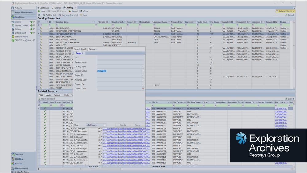
Exploration Archives centralises the management of seismic contracts, entitlements, and ownership. It automatically highlights surveys with mixed rights, flags datasets requiring legal review, and identifies media that must be split before transfer. EA’s data request workflows guide data managers through physically retrieving, validating, and preparing media for third-party delivery, ensuring nothing is overlooked.
Impact
What once took years now takes weeks.
Data management teams can deliver complete, validated seismic packages with full entitlement control, significantly reducing operational and legal risk. EA ensures operators only transfer the correct, owned data, protecting both revenue and compliance.
Challenge
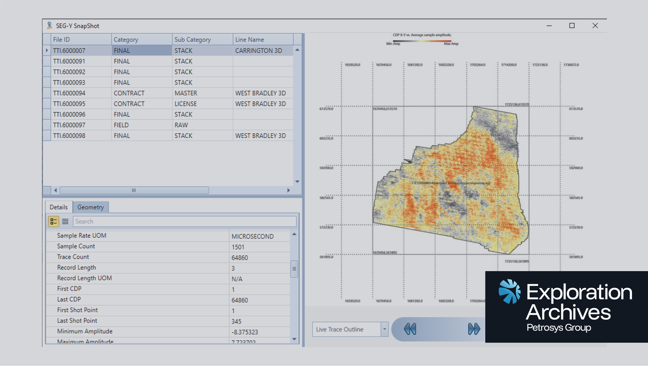
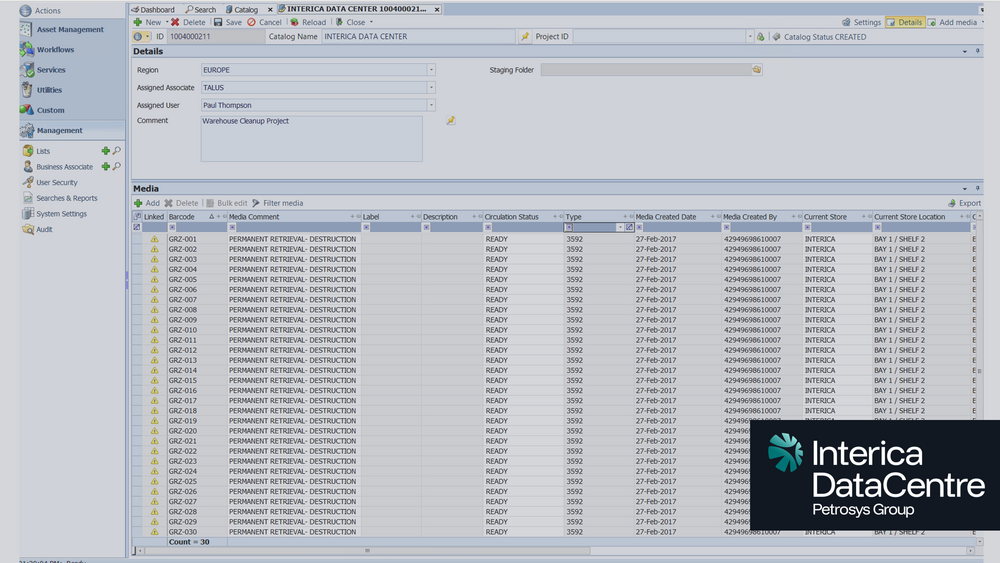
Many large operators continue to rely on physical tape media to store decades of legacy seismic, often in regions considered “low interest” at the time of acquisition. As technology improves, geophysicists revisit these historic datasets to unlock new insight, but without proper governance, locating the correct tapes across hundreds of thousands of media items becomes nearly impossible. Assets may be spread across warehouses, stored off-site, mislabelled, or, in many cases, sitting in forgotten boxes under desks. This leads to months of delay, uncertainty, and the real risk of losing high-value seismic.
Solution
Exploration Archives scans, catalogues, and classifies both physical and digital seismic assets, giving organisations complete visibility of their media estate. Operators can quickly see where legacy tapes are stored, how they are organised, and whether metadata is valid. EA’s workflow and warehouse management tools help teams remediate high-interest areas, correct inaccurate data, and prepare physical media for reprocessing or digitisation. If an area becomes active again, EA provides a governed, repeatable workflow to ensure media is located, validated, and prepared quickly and accurately.
Primary Impact
Operators who previously spent months searching for tapes now locate all required media in minutes. With EA, seismic stored across multiple warehouses, boxes, and legacy systems becomes instantly discoverable and reportable.
Additional Impact
Remediation frequently uncovers previously unrecorded or missing seismic, a multi-million-dollar asset that would have remained lost without proper visibility. EA ensures legacy seismic is no longer a liability, but an asset ready to support new exploration
Challenge:
An integrated energy company (oil, gas, geothermal and CCS) struggled with siloed technical data spread across Petrel, Landmark, GIS, SharePoint and various vendor systems.
Different departments stored “their own” version of well and seismic data, making cross-disciplinary workflows inconsistent and exposing the company to regulatory and operational risk.
Solution:
dbMap was deployed as the organisation’s enterprise subsurface master data environment, standardising corporate data governance across all teams.
Using dbMap, they:
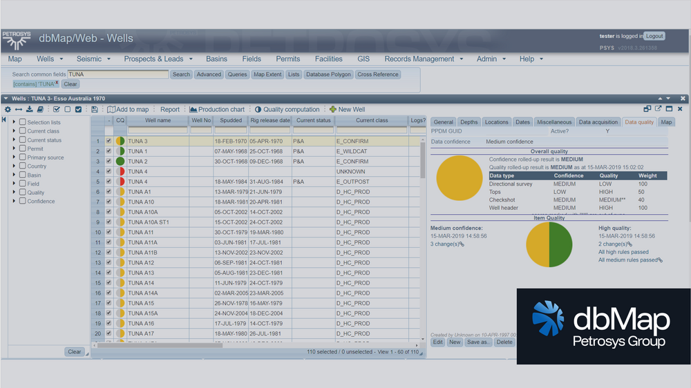
- Centralised wells, surveys, tops, logs, cores, 2D/3D seismic and leases
- Harmonised data using PPDM standards
- Implemented version control and audit trails for all updates
- Used Records Management to catalogue associated reports, log scans and physical media
- Connected dbMap to Petrel and Landmark via Exchange for controlled data flow into interpretation environments
Result:
- Consistent, trusted subsurface data feeding every technical workflow
- Data quality improved through controlled promotion workflows and metadata checks
- Faster cross-disciplinary collaboration (geology, geophysics, GIS, subsurface engineering)
- Stronger compliance position with regulators through transparent lineage and auditable processes
Challenge:
One of the largest oil and gas operators in the Middle East needed a secure disaster recovery solution to protect Petro technical data and maintain operational continuity. With thousands of legacy tapes and critical interpretation datasets at stake, any downtime could impact multi-billion-dollar projects.
Solution:
Interica DataCentre manages all disaster recovery media handling and storage for the client. Using Exploration Archives, we catalog and index every dataset, providing complete visibility and rapid retrieval. Our isolated DR environment ensures high availability and compliance with corporate resilience standards.
Impact:
The client achieved uninterrupted access to critical data, reduced downtime risk, and secured decades of subsurface information for long-term business continuity.
Challenge:
Many operators are experiencing a steady loss of experienced subsurface data managers due to retirements, restructuring, and shifting organisational priorities. As this expertise leaves the business, critical knowledge about data standards, legacy formats, physical media, and historical datasets is often lost with it.
At the same time, remaining teams are under pressure to manage growing volumes of digital and physical subsurface data with fewer resources. This creates gaps in quality control, inconsistent cataloguing practices, and increased reliance on spreadsheets or ad-hoc processes. Over time, data becomes harder to find, trust, and govern – increasing operational risk and slowing response to internal and regulatory requests.
Solution:
Interica DataCentre offers DMaaS, providing expert support for data QC, cataloging, and classification. Using Exploration Archives, we deliver a complete, searchable catalog of all datasets, ensuring governance and accessibility without increasing headcount. The DMaaS solution can be deployed in a variety of ways to suit the needs of the organization.
Impact:
Operators regain control over their data without the need to hire additional staff. By leveraging Interica DataCentre’s DMaaS and Exploration Archives, organizations achieve consistent data quality, improved governance, and faster access to critical datasets. This reduces operational risk, accelerates decision-making, and ensures long-term compliance with industry standards.
Challenge:
Submitting data to the North Sea Transition Authority (NSTA) was time-consuming and prone to errors. Operators faced deadlines and lacked automated workflows, increasing compliance risk and resource strain.
Solution:
Interica DataCentre streamlined the entire submission process. We automated validation, standardized formats, and managed secure transfers to the NSTA, ensuring accuracy and compliance without manual intervention.
Impact:
Submission time dropped, and the client maintained full regulatory compliance without diverting internal resources.
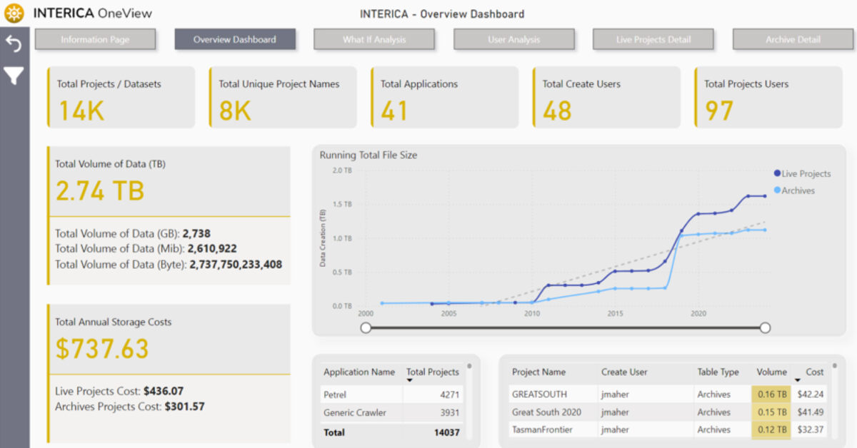
Challenge
A global energy company was struggling to make timely decisions because project data was fragmented across Petrel™, Techlog™, OpenWorks™, and network drives. Retrieving the right seismic or well dataset for analysis could take days, delaying evaluations and inflating project costs. These inefficiencies limited collaboration and obscured the true value of the organisation’s data assets.
Solution
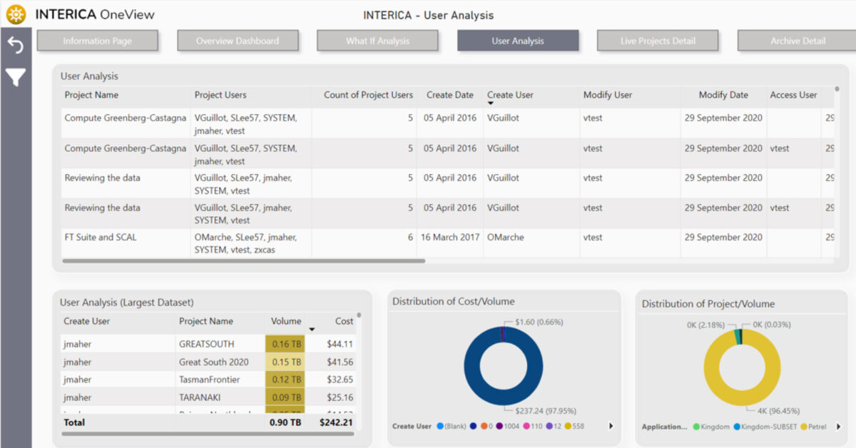
Interica OneView™ (IOV) centralised the discovery, classification, and visualisation of all subsurface information. Its intelligent connectors rapidly scanned and indexed seismic, well, and project data across applications, building a single, searchable catalogue. Integration with Power BI and Microsoft Fabric connected IOV’s curated metadata directly into enterprise analytics, enabling dynamic dashboards that revealed data age, usage patterns, and project health at a glance.
Result
With complete visibility of their data landscape, teams reduced search times by over 80%, improved collaboration between disciplines, and delivered faster technical evaluations. Real-time Power BI dashboards provided portfolio-level insight that guided reprocessing priorities and informed management decisions. The company achieved faster time-to-insight, higher data trust, and more efficient exploration planning.
Challenge
A mid-size energy company faced an escalating storage crisis. Over time, its subsurface and project data had grown to nearly 5 petabytes, spread across Windows and Linux environments and multiple applications. Annual storage management costs exceeded $7.5 million, and the sheer volume of data was blocking its cloud migration plans. Duplicate datasets, inactive project files, and unstructured archives inflated infrastructure costs and slowed performance.
Solution
The company deployed Interica OneView™ (IOV) to gain full visibility and control of its data estate. IOV rapidly scanned and indexed data across both operating systems, identifying redundant and inactive files across seismic and application domains. Using policy-based archiving, the team safely migrated 3 petabytes of data to low-cost AWS cold storage, while retaining full traceability and metadata visibility through Power BI dashboards. Asset teams could still search, locate, and request archived data through IOV’s intuitive interface, maintaining accessibility without high active storage costs.
Result
Within the first year, the organisation achieved dramatic improvements in both cost and efficiency:
- Storage footprint reduced by 60% through duplicate detection and archiving.
- Annual savings of over $4 million, including avoided costs from future growth.
- Successful cloud migration achieved with minimal disruption.
- Improved data accessibility via Power BI integration and structured metadata. IOV’s automated discovery and archiving workflows helped transform the company’s sprawling data environment into a manageable, cost-efficient system — proving that visibility and governance directly drive financial performance.

GeoSoftware, a leading provider of advanced seismic reservoir characterisation technology, saw increasing demand from its customers for OSDU-aligned workflows. While many operators were moving toward cloud-based data ecosystems, day-to-day seismic interpretation and inversion work still depended on desktop environments like HampsonRussell and Jason.
To meet customer expectations and to avoid diverting engineering resources from core product development, GeoSoftware needed a reliable, proven way to bring OSDU interoperability directly into its applications.
Challenge
- Customers wanted seamless OSDU integration without changing how they worked
- HampsonRussell and Jason needed access to trusted OSDU well data within existing workflows
- Building and maintaining custom connectors internally would be costly and slow
- GeoSoftware required a solution that aligned with OSDU standards while preserving product stability
Solution
GeoSoftware embedded Exchange as a native integration layer within both HampsonRussell and Jason
Using Exchange, GeoSoftware was able to:
- Connect directly to the OSDU Data Platform for secure read/write access to well data
- Ensure interoperability between OSDU datasets and existing seismic interpretation workflows
- Deliver integration capabilities without re-architecting core product components
- Offer customers OSDU-ready functionality with minimal disruption
Result
- Seamless OSDU-aligned workflows inside HampsonRussell and Jason
- Faster access to trusted well data and improved workflow consistency
- A significant reduction in internal development effort
- More engineering capacity for advancing high-value seismic and reservoir analysis features
Key Takeaway
By embedding Exchange, GeoSoftware delivered OSDU-compliant capabilities quickly and confidently, without sacrificing focus on its core technology.
Exchange provided the integration layer, while HampsonRussell and Jason continued to deliver the science